GEORADAR
With this measurement technology, the areas of geophysics and surveying are closely linked. If you are interested in locating interfering edges, lines, cable routes or underground foundations without having to dig complex shafts, then this method is the method of choice.
We detect underground objects and cavities up to a depth of 2 meters. The only limit is the terrain surface. If this is fastened and level, an evaluation is possible.
We can present the results to you in 3D or as a 2D site plan. If inventory documents are then also available, interpretation and allocation can be carried out efficiently.
This involves the fitting of your third-party documents or the embedding in a given coordinate system
for us of course.
Here are the advantages for you
-
Soil investigation without excavation
-
Capture in 3D
-
Determination of building and interfering edge freedom up to 2 m depth
-
large-scale analysis
-
Collision check with underfloor plan
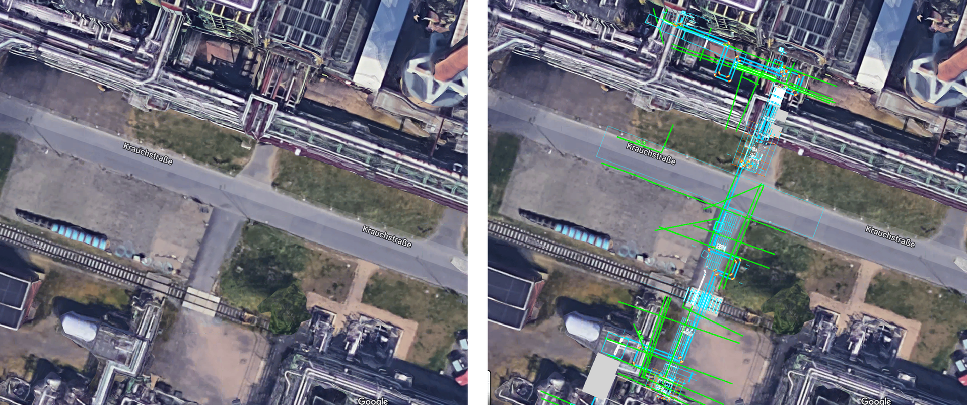
Figure left: aerial view. Figure on the right: Aerial view with the detected pipelines and cable trays.
Figure below: Point cloud or the representation of the results in 3D.


